Article by Beate Kubitz
Transport provision and population density tend to correlate closely – and in some ways, this makes a lot of sense. Services are more likely to be well used where there are large populations within a short walk of them. But what about areas where people are more thinly and evenly spread?
Many areas of the UK are populated in a pattern of small villages, spread out over large areas, rather than in high-density clusters. There may be several potential destinations for shopping, education and work, and the resulting travel patterns traced out between multiple origins and destinations show few highly utilised corridors. Bus services tend to be difficult to sustain because passenger numbers are low – both because of the absolute numbers of people within the area and also because of a high rate of car utilisation amongst those people. The net result means that the carbon footprint per person is far too high.
The challenge of creating frequent, regular fixed line services in areas like this that serve a high proportion of the population is one of the reasons that Hertfordshire developed a Demand-Responsive Transport service, HertsLynx, for one poorly-served area.
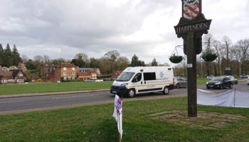
Buntingford
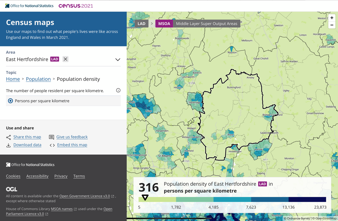
East Hertfordshire is an area with a relatively low population density, with 316 persons/km2. The neighbouring authority, North Hertfordshire is a little denser, with 355 persons/km2 [1]. However, neither authority has many large population clusters, with 40% of North Hertfordshire’s population focused outside the three towns of Baldock, Hitchin and Letchworth, whilst in East Hertfordshire around 57% are outside the two towns of Bishop’s Stortford and Ware.
There are areas where this pattern is exaggerated. The zone bounded by Royston in the north, Stevenage in the west and Bishop’s Stortford in the east, is home to around 50,000 people. with people distributed across the area in isolated dwellings, small hamlets and villages with only one small town, Buntingford (population 6,844).
The area surrounding Buntingford is very dispersed. Villages consist of just 30-40 houses. Many people travel within the area or to jobs, services and rail links located in surrounding towns: Stevenage, Letchworth, Hitchin, Baldock, Royston and Bishop’s Stortford. Two corridor bus routes cross the area but are infrequent and, before the establishment of HertsLynx, most people in the area had little or no access to public transport.
 At the same time, analysis of transport stops in the area show them to be sparse. When it comes to bus stops that are served hourly [2], only a small population segment is covered.
This notion of frequency is important for people it both empowers those dependent on public transport and enables drivers to see public transport as an alternative.
Whilst a 30-minute frequency is more standard as the ‘freedom metric’ in cities, it has been adjusted down for rural areas where there is more tolerance in general of longer waits.
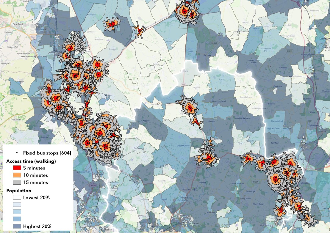
The map shows the areas which are walkable in 5, 10 and 15 minutes to these bus stops, a tiny proportion of the zone.
The large clusters in the east cover Stevenage and Royston (not part of either authority but included as a transport destination for those within the area), Hitchin and Letchworth, whilst the south-west cluster covers Bishop’s Stortford. The only places within the rural area that see buses with these frequencies are Buntingford, Standon, Ashwell (and Ashwell Station).
The net consequence is that the vast majority of the rural population of the area cannot access these bus stops, even via a 15-minute walk – an estimated 40,000 of the 50,000 people living within the area. Viewed from this perspective, it is unsurprising that people living in the area drive further and more often than average [3].
It’s also a huge issue for thoe people who do not drive or have access to a car. Poor services and long distances to bus stops represent barriers to accessing opportunities, amenities and leisure. The consequences of this can then be linked to increased loneliness and other associated costs to the local community and economy.
However, solutions for providing alternative transport in low density populations are tricky. The spread of homes – the origins of most journeys – and their key destinations; the jobs, schools, colleges, services and leisure facilities make the creation of cost-efficient routes difficult. There are multiple journey combinations, with relatively small percentages of the population making each variation, often spread across the day.
Services designed to connect people
To create services which are accessible to more of the population, bus stops need to be distributed across the area. For traditional models of bus services, this is difficult to do. However, for on-demand bus services, it is more attainable. The map below shows the distribution and walkability of the virtual bus stops for the HertsLynx DDRT service.
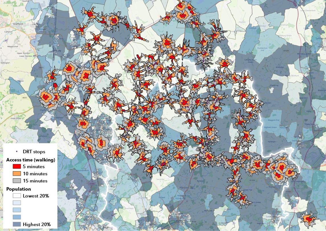
The image shows actual stops of the on-demand bus service launched in the zone, with walking isochrones at 5, 10 and 15 minutes. Stops in Royston, Bishop’s Stortford, Letchworth, Hitchin and Stevenage are ‘key hubs’ and lie outside the zone served. They are interchanges and can’t be used to travel within the towns.
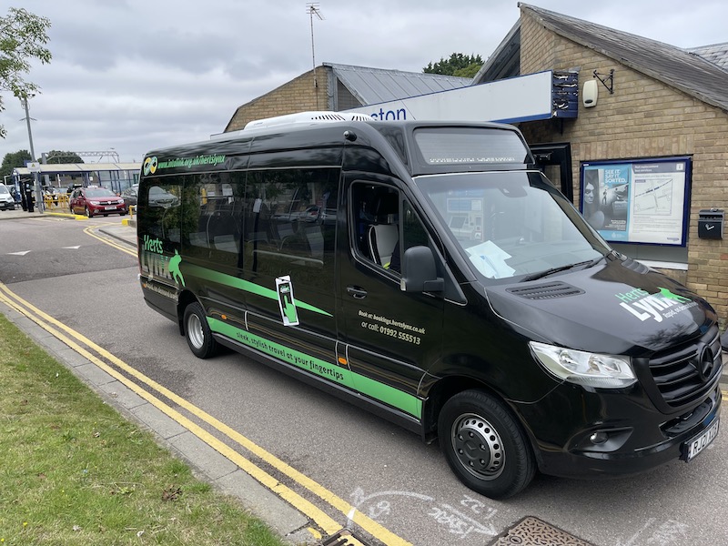
HertsLynx
The HertsLynx service was commissioned by Hertfordshire County Council funded by the DfT Rural Mobility Fund and launched in 2021, with three minibuses.
HertsLynx service is designed to cover a higher percentage of the population, enabling many more people to walk to meet buses from most of the hamlets and villages.
Initially journeys were from ‘free floating’ areas to key hub towns but increasingly, journeys are being made within the zone and the buses being used for trips like GP visits, social calls and shopping. School and college students have proved to be enthusiastic users with up to 12% of daily trips serving the college north of Buntingford. These students would previously have been reliant on lifts from family and friends.
It exceeded its year one target of 12,000 trips within 10 months. By the end of the first year, over 350 trips per week were made on the service. Many people have become regular users, booking ahead to ensure that they can reach their destinations in a timely fashion.
[1] ONS https://www.ons.gov.uk/visualisations/censuspopulationchange/E07000242/
[2] Jarrett Walker, Human Transit: How Clearer Thinking about Public Transit can Enrich our Communities and our Lives, 2011
[3] Morgan, Malcolm, Anable, Jillian, & Lucas, Karen. (2021). A place-based carbon calculator for England. Presented at the 29th Annual GIS Research UK Conference (GISRUK), Cardiff, Wales, UK (Online): Zenodo. http://doi.org/10.5281/zenodo.4665852